Cycling in Hammersmith and Fulham under the GLC
originally posted on hfcyclists
On YouTube a video has been uploaded originally made in 1984 to show progress made on cycling by the Greater London Council in coordination with boroughs. At the time the Greater London Council (GLC) had helped fund the beginnings of a cycling network and improve cycling throughout London. Much of the work took place in Hammersmith and Fulham. There are even animations (specially commissioned) which show how many of the early junctions in Hammersmith worked.
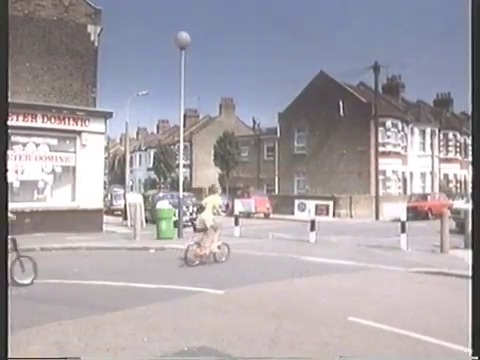
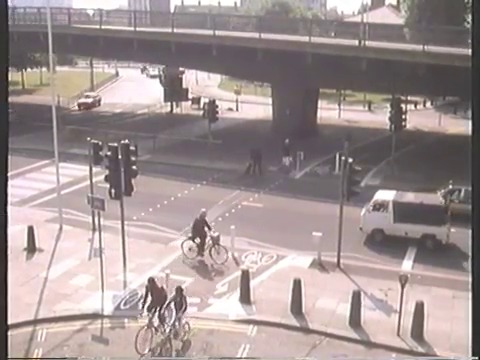
Of particular note to us are absolutely amazing sections showing then new facilities at various parts of Hammersmith. Every facility has inevitably been reworked in the decades since and indeed some are actually even preserved in a form on Google Street View (which we’ve linked in captions below the images) that has only recently been further revamped. The point to note from all of this is that it does at least appear the borough have been capable of renewing and maintaining a cycle network if not extending it in the years since. These are just some that we’ve noticed, let us know if you spot any others.


All this and more is in the video which is a very informative and fascinating 24 minutes or so of viewing. You’ll realise just how quickly changes can and were made back then, and of course how few changes have been made since. We note that most changes in Hammersmith and Fulham have been to the quality of these interventions but not to create that many more . The main thing sadly missing is the contraflow lane on Hammersmith King Street which followed some years later, just after the GLC was abolished by the Thatcher government.
The film ends with a comment which remains accurate even today, sadly: “If we are to create another generation of cyclists, we must plan London for them now.” On which note, don’t forget our Space For Cycling meeting is on Monday!
Some Research Of Our Own
Now beyond the material in the film we have also been doing research online, in libraries and in borough archives.
There is very little in newspapers of the time online (other than the Times archive) but that reveals that the GLC’s team in 1982 comprised 4 full-time and up to 36 part-time staff. It was found that changes in Fulham (probably the quiet route paralleling Fulham Palace Road) had increased cycling by 22%.

The plans of the time were advanced even in 1982 when the Times wrote (May 03, 1982; pg. 5; Issue 61223) of “cycle ways, possibly underground” being considered across London. This was happening during a time when public transport provision was being forced to be reduced in London and traffic on the streets was growing. Cycling was positioned by the GLC as an alternative (40% of those losing services were expected to walk or cycle, as opposed to 20% to drive).
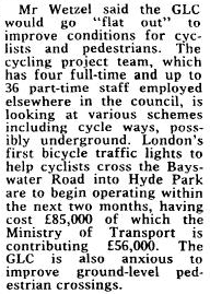
The then new crossing into Hyde Park from Bayswater cost £85k (roughly £254k in cost today) of which the Ministry of Transport contributed £56k. Those were the first bicycle traffic lights in London, installed in 1982. It seems sad that we are only just seeing moves towards low level lights in London now.
eBay brought our coordinator a copy of an original map from around the time of this film for planning routes with the GLC. We’ve quickly scanned it in to share as it’s a timely reminder both of how long ago and how compromised past efforts were, but also shows where there are differences and similarities to the current Central London Grid proposal.

It is very interesting to compare this to the current (last revised in 2006) map of walking and cycling routes as available on the council website today. The basic grid was delivered with interventions at a few key places in the early 80s. Some routes have been added, some taken away. Though note that now the map is much more likely to include a road with a bus lane or even just cycles painted on the road. It is probably quite interesting to look at why certain roads were no longer considered part of the network. Cycling on main roads has become more accepted by the council, but interventions – other than segregated contraflows or bus lanes – have not.

You might ask how seriously are the borough taking cycling, when the biggest shopping centre in West London isn’t even on the local cycle map. And if you are inspired to campaign then you could help us work on Space For Cycling, come to our meeting on Monday 17th February or read over our comments on the Central London Grid and send your own response.
We’ll follow up in time with some period leaflets and other items we’ve found, though we welcome any contributions people have of memories and artefacts of cycling in London and our local area. Drop us a line by commenting below or email us.
Pingback: Cycling in London after the GLC had gone - Amble Scope